Western Sahara and Morocco
December 2020 update to this page:
The US recognizes Morocco’s sovereignty over Western Sahara
Western Sahara is the region south of Morocco. It’s a disputed territory partially controlled by the self-proclaimed Sahrawi Arab Democratic Republic and partially occupied by neighboring Morocco. It is one of the most sparsely populated and arid territories in the world, mainly consisting of desert flatlands. There are no permanent streams. Aside from its rich fishing waters and phosphate reserves, Western Sahara has few natural resources and lacks sufficient rainfall and freshwater resources for most agricultural activities.
Western Sahara used to be occupied by Spain. In 1975, Spain gave up the area and gave control to both Morocco and Mauritania for joint administration. A war broke out between those two countries and a Sahrawi nationalist movement (the native people living in the area) called the Polisario Front proclaimed the area as the Sahrawi Arab Democratic Republic (SADR). Mauritania withdrew its claims, but Morocco didn’t and took control of most of the territory. Since a cease-fire agreement in 1991, 2/3’s of the territory has been governed by Morocco with tacit support from France and the United States. The remainder of the territory has been administered by the SADR, backed by Algeria.

Most food for the urban population comes from Morocco. The Moroccan government encourages citizens to relocated to the territory by giving subsidies and price controls on basic goods.
A subsidy is a contribution of money.
Some leaked diplomatic cables revealed that the territory is somewhat of an economic burden for Morocco; as the $800 million subsidy program to Western Sahara was said to be one of the larger per-capita aid programs in history. Supporting life in a territory with scarce freshwater resources is extremely costly. Fuel is sold at half the price, and basic goods are heavily subsidized; businesses operating in the territory do not pay taxes. The territory is otherwise thought to be economically unviable and unable to support its population without the Moroccan subsidies.
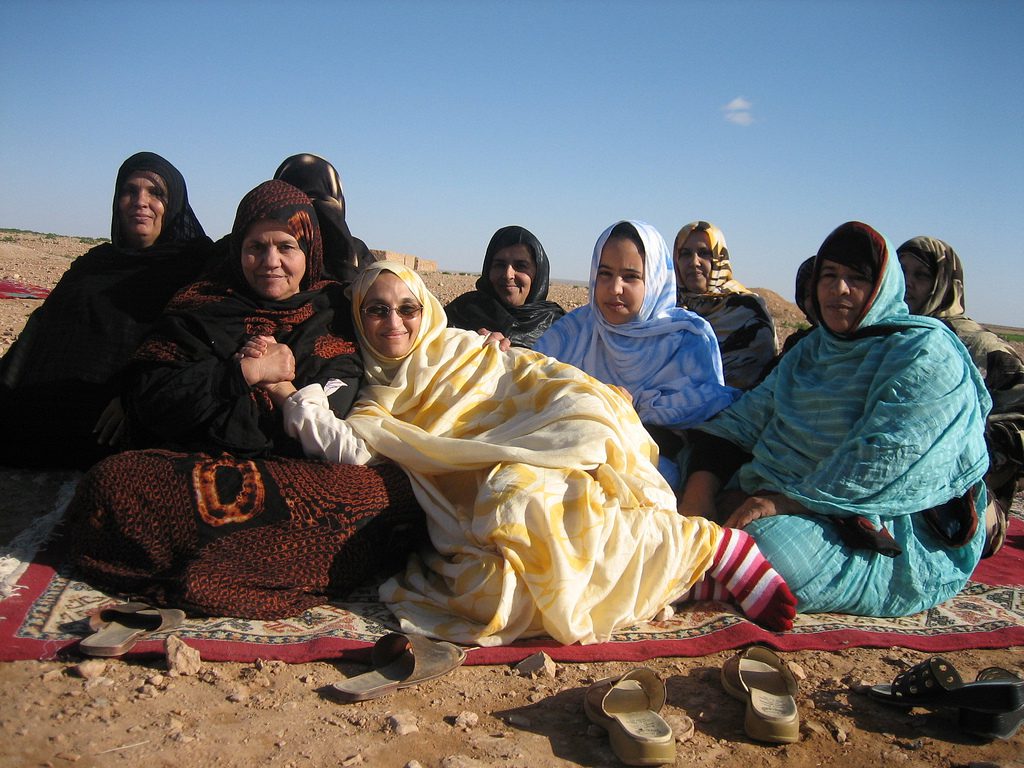
The indigenous population of Western Sahara is usually known in Western media as Sahrawis, which are traditionally nomadic Bedouins.

The Polisario-controlled parts of Western Sahara are barren. This area has a very small population, primarily made up of nomads who engage in herding camels back and forth between the Tindouf area (a town in Algeria) and Mauritania. However, the presence of land mines scattered throughout the territory by the Moroccan army makes it a dangerous way of life.
In Sahrawi ethnic groups, the concept of beauty is embodied through the practice of fattening. Before marriage, girls intentionally overeat and perform limited physical activity for 40 days in order to be attractive for their soon-to-be husbands. Women will repeat this process if they want to gain weight after marriage. It is believed that traditional clothing of these ethnic groups require a heavier body in order to be attractive.
The Western Saharan cuisine has several influences, one of those being Spanish cuisine due to previously being colonized by Spain. Food is primarily imported into Western Sahara, as minimal rainfall in the territory inhibits agricultural production. A major staple food is couscous that often accompanies one way or another all the food dishes. Camel and goat are preferred meats, as well as lamb. Pork isn’t eaten. Some fruits and vegetables are grown in oases.

For over 30 years, several tens of thousands Sahrawi refugees have been living in the region of Tindouf, Algeria, in the heart of the desert, in four refugee camps.

Note: The beginning of this video shows someone being hit with a baton. Violence is discussed.
Morocco

Morocco overlooks the Mediterranean Sea to the north and the Atlantic Ocean to the west. It claims the exclaves of Ceuta, Melilla, and Peñón de Vélez de la Gomera, all of them under Spanish jurisdiction, as well as several small Spanish-controlled islands off its coast.


Morocco also claims Western Sahara, as discussed above.
The geography of Morocco spans from the Atlantic Ocean, to mountainous areas, to the Sahara desert. A large part of Morocco is mountainous. The Atlas Mountains are located mainly in the center and the south of the country. The Rif Mountains are located in the north of the country.


Both ranges of mountains in Morocco are mainly inhabited by the Berber people. Traditionally, Berber men take care of livestock. They migrate by following the natural cycle of grazing and seeking water and shelter. Women look after the family and handicrafts. The Berber tribes traditionally weave kilims, a type of tapestry-woven carpet.

The social structure of the Berbers is tribal, and the majority of Berber tribes currently have men as heads of the tribe.

The country’s Mediterranean climate is similar to that of southern California, with lush forests in the northern and central mountain ranges of the country, giving way to drier conditions and inland deserts further southeast. The southeastern-most portions of Morocco are very hot and include portions of the Sahara Desert, where vast swathes of sand dunes and rocky plains are dotted with lush oases.

The Moroccan coastal plains experience remarkably moderate temperatures even in summer, owing to the effect of the cold Canary Current off its Atlantic coast. In some parts of the Middle Atlas Mountains, there are ski resorts.
The country wields significant influence in both Africa and the Arab world and is ruled by a king who holds executive and legislative powers, especially over the military, foreign policy, and religious affairs. There is also a government, a Prime Minister, and two chambers of parliament. Morocco’s predominant religion is Islam, and its official languages are Arabic and Berber. French is also widely spoken.
The major resources of the Moroccan economy are agriculture, phosphates, and tourism. Cannabis is also cultivated in the Rif region (and has been since the 7th century). In addition to that, Morocco is a transit point for cocaine from South America destined for Western Europe.

Morocco’s culture is primarily Muslim. Influences from the Arab world, Spain, Portugal, and France are seen in Moroccan culture, both on their own and blended with Berber and Islamic styles.

Moroccan cuisine is considered as one of the most diversified cuisines in the world. This is a result of the centuries-long interaction of Morocco with the outside world. Moroccan cuisine is known for using couscous, herbs like cilantro, parsley, and mint, as well as tomatoes, onions, garlic, zucchini, and eggplant. Spices are used extensively. Chicken is the most widely-eaten meat.


Libya

Libya is a large country with a relatively small population, and the population is concentrated very narrowly along the coast (notice where the cities are located on the map above).
Libya was part of the Roman Empire after being ruled by Carthaginians, Persians, Egyptians, and Greeks. After the fall of the Roman Empire, invasions brought Islam to the area. Ottoman rule began in 1551 and then Libya was occupied by Italy starting in 1911. During the Second World War, Libya was an important area of warfare in the North African Campaign and became independent as a kingdom in 1951.
Muammar Qaddafi (also known as: Moammar Gadhafi, Muʿammar al-Qadhdhāfī, Muammar Kaddafi, Muammar Khadafy, and Muammar al-Gathafi) came to power in Libya in 1969 by overthrowing the king and never held an election for political control. He used Libya’s oil revenues to build up the country’s infrastructure, enhance his military, and create an anti-Western terrorist network with weapons production. Personal freedoms were limited in Libya, and there was no free speech, freedom of the press, or freedom of assembly. Qaddafi supported various Islamic terrorist groups and nationalized all the oil assets of international corporations in Libya in the early 1980s. Qaddafi was overthrown and killed in the 2011 Libyan Civil War. A 2nd civil war broke out in 2014 with a ceasefire occurring in 2020. Libya has been torn among numerous rivals, armed militias affiliated with distinct regions, cities, and tribes, while the central government has been weak and unable effectively to exert its authority over the country. Competing militias pitted themselves against each other in a political struggle between Islamist politicians and their opponents.
Libya has a violent past and present. Watch the following videos to understand a bit more about this country:
Note: Some violence is shown and discussed. There is one bad word spoken and one translated via the subtitles.
Libya’s coastline is the longest of any African country bordering the Mediterranean. The climate is mostly extremely dry and desertlike in nature. The Libyan Desert, which covers much of Libya, is one of the most arid and sun-baked places on earth. In places, decades may pass without seeing any rainfall at all, and even in the highlands rainfall seldom happens, once every 5–10 years.

The Libyan economy depends primarily upon revenues from the oil sector, which accounts for 97% of exports. Libya holds the largest proven oil reserves in Africa.

Family life is important for Libyan families, the majority of which live in apartment blocks and other independent housing units, with precise modes of housing depending on their income and wealth. Although the Arab Libyans traditionally lived nomadic lifestyles in tents, they have now settled in various towns and cities. Because of this, their old ways of life are gradually fading out. An unknown small number of Libyans still live in the desert as their families have done for centuries. About 97% of the population in Libya are Muslims, most of whom belong to the Sunni branch.

The largest and capital city of Libya is Tripoli.

Libya has various ruins from centuries of occupants. One of the most famous is Leptis Magna, which was part of the Roman Empire. The following video shows some of this amazingly preserved city.
We want to know what you thought of what you just read and watched! Leave us a comment! Please also let us know if a link or video isn’t working. ?
Next: 9.2: Subsaharan Africa
Additional information and image credits:
Libya control of cities Wikimedia Commons – CC0 – public domain.
https://en.wikipedia.org/wiki/Western_Sahara
Sahara map By Universalis – This file was derived from: Sahrawi Arab Democratic Republic (orthographic projection) highlighted.svg:, CC BY-SA 4.0, https://commons.wikimedia.org/w/index.php?curid=44576316
Sahrawi man By Saharauiak – Old man and his camel, CC BY-SA 2.0, https://commons.wikimedia.org/w/index.php?curid=11783523
Sahrawi women By Saharauiak – Happy with her friends, Sahrawi women, CC BY-SA 2.0, https://commons.wikimedia.org/w/index.php?curid=1332325
Refugee camp By European Commission DG ECHO – The Sahrawi refugees – a forgotten crisis in the Algerian desert, CC BY-SA 2.0, https://commons.wikimedia.org/w/index.php?curid=20205931
https://en.wikipedia.org/wiki/Culture_of_Western_Sahara
https://en.wikipedia.org/wiki/Western_Saharan_cuisine
Making bread By Laura Dauden – Own work, CC BY-SA 4.0, https://commons.wikimedia.org/w/index.php?curid=64255814|
Morocco map By OCHA, CC BY 3.0, https://commons.wikimedia.org/w/index.php?curid=32296403
Melilla By TUBS – Own workThis W3C-unspecified vector image was created with Adobe Illustrator.This file was uploaded with Commonist.This vector image includes elements that have been taken or adapted from this file: Spain location map.svg (by NordNordWest).This vector image includes elements that have been taken or adapted from this file: España-Canarias-loc.svg (by Miguillen)., CC BY-SA 3.0, https://commons.wikimedia.org/w/index.php?curid=14520625
Ceuta By TUBS – Own workThis W3C-unspecified vector image was created with Adobe Illustrator.This file was uploaded with Commonist.This vector image includes elements that have been taken or adapted from this file: Spain location map.svg (by NordNordWest).This vector image includes elements that have been taken or adapted from this file: España-Canarias-loc.svg (by Miguillen)., CC BY-SA 3.0, https://commons.wikimedia.org/w/index.php?curid=14520490
https://en.wikipedia.org/wiki/Morocco
Anti-Atlas mountains By Bjørn Christian Tørrissen – Own work by uploader, http://bjornfree.com/galleries.html, CC BY-SA 3.0, https://commons.wikimedia.org/w/index.php?curid=17126254
Berber village By I, Luc Viatour, CC BY-SA 3.0, https://commons.wikimedia.org/w/index.php?curid=970288
https://en.wikipedia.org/wiki/Berbers
Berber carpet By AGHU/M.O. – Own work, CC BY-SA 1.0, https://commons.wikimedia.org/w/index.php?curid=1295749
Nomadic Berber CC BY 2.0, https://commons.wikimedia.org/w/index.php?curid=1083270
Sahara in Morocco By Lefidele – Own work, CC BY-SA 4.0, https://commons.wikimedia.org/w/index.php?curid=48889362
Barely field By Ramagri – Own work, CC BY-SA 4.0, https://commons.wikimedia.org/w/index.php?curid=38692826
https://en.wikipedia.org/wiki/Culture_of_Morocco
Living room By Xiquet – Picture taken by me, Public Domain, https://commons.wikimedia.org/w/index.php?curid=3528014
Cuscus By Lmmima – Own work, CC BY-SA 4.0, https://commons.wikimedia.org/w/index.php?curid=77449852
Pastilla By Krista – bisteeyainsideUploaded by Diádoco, CC BY 2.0, https://commons.wikimedia.org/w/index.php?curid=10870563
Tajine By Arnaud 25 – Own work, CC BY-SA 3.0, https://commons.wikimedia.org/w/index.php?curid=27283574
Libya map By OCHA, CC BY 3.0, https://commons.wikimedia.org/w/index.php?curid=34011152
https://en.wikipedia.org/wiki/Libya
Libyan desert By Roberdan – https://www.flickr.com/photo_zoom.gne?id=86186044&size=o, CC BY-SA 2.0, https://commons.wikimedia.org/w/index.php?curid=627369
Oil map By NordNordWest, Yug – File:Libya_location_map.svg by user:NordNordWestPetroleum Economist (http://www.petroleum-economist.com/), published in The Economist, The colonel feels the squeeze, May 19th 2011.Related to : File:Libyan_Uprising.svg, CC BY-SA 3.0, https://commons.wikimedia.org/w/index.php?curid=15255048
Mosque By Franzfoto – Own work, CC BY-SA 3.0, https://commons.wikimedia.org/w/index.php?curid=12160741
Tripoli By Bryn Jones – originally posted to Flickr as Tripoli, CC BY 2.0, https://commons.wikimedia.org/w/index.php?curid=4513530

Hello! I love this South African live cam and wanted to share it in case you’d like to add it to the resources section in sub-Saharan unit of the geography curriculum: https://www.youtube.com/watch?v=-nktElu7GSw&pp=ygUVYmlyZCB3YXRjaGluZyBocSBsaXZl
The cam even shares what creature/animal you’re seeing (it’s typed in the right, bottom corner of the screen).
Thank you so much for this online curriculum!! 😊
Thank you so much for sharing! 🙂
Libya is has been under a ceasefire from 2020-now 🙂
Thanks for helping us to keep everything updated! We so appreciate you! <3
Also, Muammar Gaddafi’s name is spelled wrong
Thank you for letting us know!! <3
The “Muammar al-Qaddafi – Dictator | Mini Bio | BIO” video is no longer available!
Thank you SO much for letting us know! We so appreciate you! I’ll find a replacement asap! 🙂